|
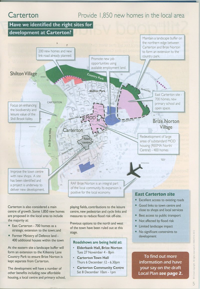
People living in new houses on the East site would be
unlikely to walk into the centre and if getting into their
cars they will head to Witney. [MF 27/11/12]
The proposed development says there is excellent access to
existing roads. But what happens when the traffic
stops
flowing?
|
|
Increased traffic is a major worry
for the villagers of Brize Norton. How will we be affected?
We are led to believe that all road traffic from the proposed
development will be onto Monahan Way. So where will the extra
traffic go?
The planners will argue that a new road (marked on their map in dotted
lines) will direct
traffic onto the Curbridge Road. Where is the money for this
coming from? When will it happen?
But what of traffic that needs to
head south through Bampton onto the A420 or through Clanfield and
Faringdon?
In addition there will be extra traffic emanating from Carterton with
the growth in population elsewhere in the town. What of
traffic attracted to developments such as Morrisons superstore.
So how much more traffic can we stand?
Looking further afield, how much traffic can the A40 take, congestion
here leads to pressure to use the A420 to get into Oxford. |